

Time, person, and place are 3 main epidemiologic variables; place, however, has always been the most difficult and time consuming to analyze and illustrate [1]. In addition, the majority of data for demographic, socioeconomic, environmental pollution, and health outcomes have a common aspect; all of these data can be located within space as a point, line, or area [2]. Because where people live, work, learn, and play can affect their health and well-being, these location data are gaining momentum as an important part of epidemiology and can be assessed with advanced technology and analytic methods. Spatial analysis in epidemiology is a field dealing with spatial or spatiotemporal data, which can be linked to the phenomenon of disease spread or population at risk [3].
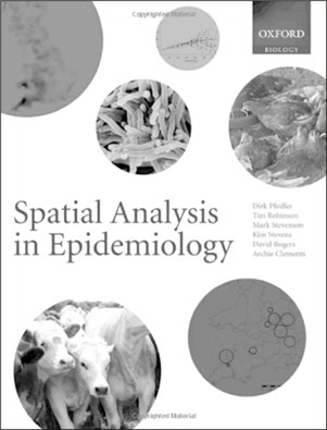
This book, Spatial Analysis in Epidemiology, consists of 8 chapters. Chapter 1 is an introduction to the concepts and framework for spatial analysis, available software, and the basics of spatial data by providing readers with many references, Web sites, and information sources. Chapter 2 dives into more detail about spatial data and spatial effects in conjunction with the geographic information system (GIS), such as data types, collection, and management. Especially for someone who is not familiar with GIS as a powerful tool for dealing with such spatial data, chapter 2 will be an essential read. Chapter 3 focuses on the visualization and representation of spatial data. Examples of geographical data were described as point data (e.g., disease cases, attribute values), aggregated data (e.g., total, mean, and median), and continuous data (e.g., temperature, air pollution). Chapters 4 and 5 introduce spatial clustering for disease at global and local levels, which is very useful for spatial aggregation of disease cases. These 2 chapters provide various methods and statistics dealing with aggregated and point data for spatial clustering that has great potential as an alarm system for disease clustering. Chapter 6 deals with spatial variations in risk, and chapter 7 focuses on modeling of spatial distribution of diseases. Finally, chapter 8 explains data-driven and knowledge-driven modeling for risk assessment and management to help decision-makers set and enact effective measurement of incidences of infectious and chronic health conditions. As the authors mention, spatial analysis and GIS are great examples of tools for decision makers who are looking for ways to predict, detect, and control risks and diseases as well as promote health.
We can see that geographic information can be found and collected from a wide range of sources in recent times, such as traffic navigation systems and mobile/smart phones that use a geographic global positioning system. These location data can be processed within GIS, which is a computer system for the input, editing, storage, maintenance, management, retrieval, analysis, synthesis, and output of geographic or location-based information [4]. GIS can help health professionals explore and examine the distribution of people at risk by focusing on combinations of their risk factors and health outcomes in terms of their geographic relations [5,6]. In many parts of the world, GIS has been part of an important government infrastructure that promotes nationwide use for health-related data and more [7-9]; therefore, spatial analysis methods and GIS can contribute to the enhancement of our understanding and visualization of spatial and health data hand-in-hand.
As the authors mentioned, this book, Spatial Analysis in Epidemiology, is written mainly for postgraduate and postdoctoral students who are interested in epidemiology and spatial analysis; however, it can be useful to researchers in other fields related humans and animals, such as ecology, zoology, environmental science, geography, and statistics. This book is a great introduction to the topic of spatial epidemiology, although it is not extensive enough for in-depth spatial analysis in epidemiology, with less than 200 pages. However, data collected through surveillance systems provide a backbone of epidemiological study, and these 2 exciting areas are closely related to healthcare informatics, as technology has advanced to collect data extensively and effectively and to perform epidemiological research using various tools.